
As we approach Disaster Prevention Week in September 2026, nationwide interest in the correlation between urban disaster prevention and real estate values is higher than ever. In particular, Kagoshima City, Kagoshima Prefecture (鹿児島県鹿児島市), with its unique topography featuring close proximity to the sea and mountains, along with an active volcano, stands as a symbolic area where responses to complex disaster risks significantly dictate real estate market trends.
This article thoroughly verifies the reality of flood and landslide risks in Kagoshima City, and the subsequent shift in housing demand toward elevated and inland areas, based on the latest data (aggregated from 2021 to 2025) from "Mekiki Research" (物件目利きリサーチ). We will unravel the key points of area selection to balance disaster resilience and asset value from the perspective of professional real estate analysts.
Summary of Investment Decisions in This Article
- While Kagoshima City's real estate market remains solid with an average transaction price of approximately 29.68 million yen, price formations factoring in "hazard risks" have become pronounced by area.
- Flood risks with a maximum inundation depth of "5 to 10 meters" have been confirmed in coastal and low-lying areas. In exchange for the convenience brought by redevelopment, resilience investments (e.g., flood countermeasures) have become essential.
- Elevated areas such as Ishikidai (伊敷台) attract concentrated housing demand regardless of the property's age, forming stable land prices. Meanwhile, the suburban and inland area of Ishidani-cho (石谷町) sees strong inquiries for logistics and industrial real estate.
- Investors are required to clearly separate their portfolios between yield-focused properties in the city center and capital-preservation, end-user-oriented properties in elevated areas.
1. Introduction: The 2026 Disaster Prevention Week and the Importance of Urban Disaster Prevention in Kagoshima City
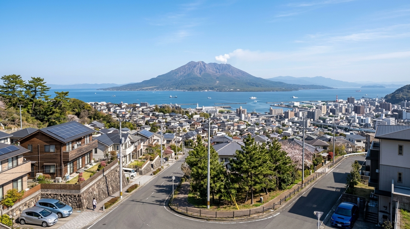
Kagoshima City, Kagoshima Prefecture (Municipality Code: 46201) possesses a unique topography where plains facing Kinko Bay (錦江湾) and steep elevated areas known as the Shirasu Plateau (シラス台地) intermingle in a mosaic pattern. In recent years, due to the increase in localized torrential rains caused by climate change and heightened vigilance against the Nankai Trough Megaquake (南海トラフ巨大地震), the importance of "hazard resilience" in real estate purchases has grown dramatically.
First, let's grasp the overall market picture from actual data for the entirety of Kagoshima City between 2021 and 2025, obtained from our site, Mekiki Research.
| Item | Data Content (Target Period: 2021-2025) |
|---|---|
| Total Transactions | 7,868 transactions |
| Average Transaction Price | Approx. 29.68 million yen (29,679,157 yen) |
| Median Transaction Price | Approx. 20 million yen (20,000,000 yen) |
| Highest Transaction Price | 2.8 billion yen |
| Lowest Transaction Price | 400 yen |
| Average Unit Price | Approx. 94,000 yen/sqm (93,854 yen/sqm) |
As indicated by the abundant sample size of 7,868 total transactions, Kagoshima City's real estate market is highly active. The average transaction price is approximately 29.68 million yen, while the median is about 20 million yen. This suggests that although a few ultra-high-value transactions (highest at 2.8 billion yen) push up the average, the transaction volume zone for typical end-users is concentrated around 20 million yen. The average unit price stands at approximately 94,000 yen/sqm, maintaining a firm market as a regional core city.
If you are looking for trends in off-market properties in this area or more detailed market analysis reports, please utilize our site's database.
2. Current Status of Complex Disaster Risks in Kagoshima City (Tsunamis, Storm Surges, Landslides, and Sakurajima Volcanic Ash)
In real estate investment and home purchasing, hazard information is now the most critical factor to consider. The data obtained this time confirmed that extremely serious risks are inherent in certain areas of Kagoshima City.
- Flood Risk: Present (Max Inundation Depth Rank 4: 5 to 10 meters)
- Landslide Risk: Present (Phenomenon: Debris Flow)
※WARNING※ A maximum inundation depth of "5 to 10 meters" is an extremely dangerous level, suggesting the possibility of buildings being submerged up to their second or third floors. Furthermore, if a "debris flow" occurs, it causes fatal damage, leading to building collapse and loss of life. When considering properties in Kagoshima City, do not rely solely on yield and price; be sure to cross-reference with the hazard maps of each municipality before purchasing to strictly verify whether the target property falls within these risk areas.
The complex disaster risk, combining the fragile geology characteristic of the Shirasu Plateau with storm surges and torrential rains during typhoons, has begun to function as an undeniable negative factor (risk premium) in Kagoshima City's real estate valuation.
The latest hazard information for specific addresses or pinpoint locations can be instantly checked using Mekiki Research's map function.
3. Changes in Real Estate Transactions and Stricter Risk Assessments in Coastal and Low-Lying Areas
The area around Tenmonkan (天文館), Kagoshima City's commercial center, and coastal low-lying areas boast high convenience and a concentration of economic activities. According to actual data, the nearest station, Tenmonkandori Station (天文館通駅) (operated by Kagoshima City), sees 4,578 daily passengers, and the surrounding area is designated as a "Commercial Zone" with an 80% Building Coverage Ratio (BCR) and 400% Floor Area Ratio (FAR).
Additionally, the school districts include Meizan Elementary School (名山小学校) and Nagata Junior High School (長田中学校), and the area houses a staggering 101 medical institutions (such as Takada Hospital (高田病院), Izuro Imamura Hospital (いづろ今村病院), and Sakimoto Hospital (﨑元病院)). This overwhelming concentration of medical infrastructure is a significant advantage, particularly for the residential needs of seniors and investments in commercial real estate like clinic buildings.
However, as mentioned earlier, much of this area has a low elevation above sea level, carrying a flood risk of "5 to 10 meters" during storm surges and river floods. Consequently, in recent years, a "strictification of risk assessment" has been progressing on the ground level. Properties without flood countermeasures—such as using the first floor for pilotis (parking) and placing residential and electrical equipment on the second floor or higher—face stricter loan screenings or struggle to attract tenants.
For criteria on selecting high-resilience income properties in commercial areas, individual consultations with expert analysts from our site are also available.
4. The Shift in Housing Demand and Background of Rising Land Prices in Elevated and Inland Areas Like Murasakibaru and Yoshino
As disaster risks in coastal and low-lying areas become apparent, housing demand—primarily from end-user families—is rapidly shifting toward elevated areas and inland regions such as Murasakibaru (紫原), Yoshino (吉野), and Ishikidai. This trend is also evident in our recent data.
Transaction Examples for Housing in Ishikidai (Category I Exclusively Low-Story Residential Zone, BCR 50% / FAR 80%)
- Built in 1995 (Wooden, 140 sqm): Approx. 21 million yen
- Built in 2021 (Wooden, 145 sqm): Approx. 29 million yen
Both transactions took place in the first quarter of 2021, and the fact that a 26-year-old property sold for 21 million yen is noteworthy. Normally, the building value of a wooden detached house is considered almost zero after 20 years, but this price is evidence that "the safe, elevated land of Ishikidai" itself is highly valued. The fact that the price difference from a new build (29 million yen) is kept within 8 million yen further highlights the solid land prices in elevated areas.
The data for the inland area of Ishidani-cho (石谷町) is also intriguing.
- Land (Outside Urbanization Promotion Areas, etc., BCR 60% / FAR 200%): Approx. 6.7 million yen for 270 sqm, and approx. 8.5 million yen for 340 sqm. The unit price for both is approx. 25,000 yen/sqm.
- Factory/Office (Semi-Industrial Zone, BCR 60% / FAR 200%): Built in 1998 (Steel frame, 1,300 sqm) for approx. 48 million yen.
Ishidani-cho includes areas where flexible development is possible, such as those outside urbanization control areas. Thanks to its affordability at around 25,000 yen/sqm, demand is growing for suburban detached houses requiring large lots and as relocation sites for commercial and logistics hubs avoiding flood risks. On the other hand, a transaction for agricultural land (890 sqm) in Inuzako-cho (犬迫町) was seen at approximately 1.3 million yen, indicating a clear price gap between pure agricultural land/forests and inland areas capable of residential development.
The latest transaction trends for detached housing lots in elevated areas and commercial land in inland areas can be analyzed in detail using Mekiki Research's advanced search filters.
5. Latest Trends in Area-Specific Land Price Structures Brought About by Disaster Hazard Map Revisions
Urban land price structures are constantly updated by changes in awareness of hazard risks and the subsequent progress of redevelopment. By organizing the timeline of major recent redevelopments in Kagoshima City, it becomes clear that disaster prevention and the reorganization of urban functions are closely linked.
| Period | Trends in Major Redevelopment and Infrastructure Development |
|---|---|
| 2021 - | Progress in the development of the Kagoshima-Chuo Station (鹿児島中央駅) West Exit area (mixed-use commercial, office, and residential). |
| 2022 | Opening of the Sennichicho 1 & 4 Block Urban Redevelopment Project (CenTerrace Tenmonkan (センテラス天文館)). Improvement of navigability in the central urban area. |
| 2025 - 2026 | Full-scale implementation of the redevelopment plan for the Kagoshima Port Honko Area (鹿児島港本港区). Creation of waterfront spaces and enhancement of storm surge/tsunami countermeasures. |
| 2027 onwards | Widening of access roads to elevated areas (Murasakibaru, Yoshino, etc.), renewal of aging infrastructure, and promotion of disaster prevention hubs. |
While redevelopment investments in the central urban area (around Tenmonkan and Kagoshima-Chuo Station) remain active, coastal areas like the "Kagoshima Port Honko Area" require developments that incorporate protective functions against storm surges and tsunamis (a super-levee approach) rather than simple commercial development.
Conversely, although elevated areas have established popularity as residential zones, they face challenges such as traffic congestion on access roads crawling up steep slopes and cliff areas with debris flow risks (increasing maintenance costs for retaining walls). Future land price trends will become more strictly selective, shifting from the phase of "any elevated land is good" to "flat land within elevated areas where infrastructure is updated and completely separated from landslide risks."
Mapping of redevelopment plans and future land price forecasts for each area is regularly distributed in our premium member reports.
6. Trends in Newly Built Condominiums and Detached Houses with Enhanced Disaster Resilience
In response to these changes in the land price structure, the supply strategies of developers and house builders have also shifted significantly.
For newly built condominiums supplied in low-lying and coastal commercial zones (e.g., FAR 400%), designs premised on inundation risks (5 to 10 meters) have become the standard. Specifically, power receiving equipment (cubicles) and emergency generators are installed on rooftops or middle floors, and waterproof barriers are fully equipped at first-floor entrances. Furthermore, an increasing number of properties feature unique ventilation systems considering Sakurajima's (桜島) volcanic ash and the adoption of enclosed inner balconies. These "disaster prevention premiums" push up construction costs, resulting in an upward trend in the sales prices of new condominiums.
Meanwhile, the supply of detached houses dominates in inland areas like Ishidani-cho and elevated areas like Ishikidai. Here, due to caution against landslide risks (debris flows), proving the safety of retaining walls behind properties and thorough ground improvement work are required. As seen in the aforementioned transaction of a 1,300 sqm steel-framed factory in Ishidani-cho (approx. 48 million yen), an increasing number of companies are relocating their own buildings and factories to inland semi-industrial zones from a BCP (Business Continuity Planning) perspective. Investments in "safe ground" are accelerating on both the residential and industrial fronts.
For the difference in future resale value between properties with high resilience performance and those without, please utilize our data-based simulation tools.
7. Deciphering the Correlation Between Disaster Resilience and Asset Value with "Mekiki Research"
What underlies the entire sample data of 7,868 transactions verified this time is the cold fact that "disaster resilience and asset value are beginning to correlate perfectly."
In the past, "distance from the station" and "access to commercial facilities" were absolute indicators of real estate value. The number of passengers around Tenmonkandori Station and the concentration of 101 medical institutions certainly represent powerful appeal in terms of living convenience. However, in an era where maximum 10-meter inundation risks and debris flow risks have been visualized, end-users are now willing to pay a premium for "topography that protects life and property."
From an investor's perspective, if you aim for high-yield properties in low-lying areas by pursuing returns, "both hard and soft defensive measures," such as comprehensive flood insurance riders and elevating equipment, are essential. Conversely, if you aim for long-term capital gain preservation and stable rental management, securing solid land in elevated and inland areas like Ishikidai and Ishidani-cho will be the most rational strategy.
To find the optimal balance of "risk and return" tailored to your own investment style, please try our site's comparative analysis function.
8. Conclusion: Real Estate Investment and Development Strategies in Kagoshima City in the Era of Complex Disaster Risks
Ahead of the 2026 Disaster Prevention Week, we have verified the relationship between complex disaster risks and real estate values using the latest data from Kagoshima City.
- Overall Market: While remaining solid with an average of approx. 29.68 million yen and a unit price of approx. 94,000 yen/sqm, polarization between areas is progressing.
- Reality of Risks: The existence of a "maximum 5 to 10 meters flood risk" in coastal and low-lying areas, and "debris flow risk" in steep slope areas.
- Shift in Demand: The movement of residential and commercial demand to elevated areas like Ishikidai (used: 21 million yen / new: 29 million yen) and inland areas like Ishidani-cho (unit price approx. 25,000 yen/sqm).
- Urban Infrastructure: The key to development is how to hedge disaster risks while enjoying the high concentration of medical facilities (101 institutions) and commercial convenience around Tenmonkan.
Real estate is literally an "immovable asset." In addition to the daily challenge of Sakurajima's volcanic ash, how should life-threatening risks like floods and landslides be evaluated and incorporated into a portfolio? Future real estate investment and development strategies in Kagoshima City begin with a careful reading of hazard maps and calm area selection based on actual data.
By registering for a free membership, you can pull the Ministry of Land, Infrastructure, Transport and Tourism data used in this blog directly from your Claude or ChatGPT (via MCP integration). Continue your research seamlessly with your own AI and utilize it for more advanced investment decisions.