
As we approach the 2026 Disaster Prevention Week (防災週間), the importance of "urban disaster resilience" in the real estate market has reached unprecedented heights. Particularly in Pacific coastal areas where the occurrence of a Nankai Trough Earthquake (南海トラフ地震) is a major concern, relocating from assumed tsunami inundation zones to inland and elevated areas goes beyond mere risk avoidance—it is driving a structural shift in real estate demand.
In this article, we will analyze the latest transaction data and hazard information for Nangoku City, Kochi Prefecture (高知県南国市) (around the city center: latitude 33.5783, longitude 133.6431). We will examine the drastic shift of residential and commercial demand from coastal areas to elevated grounds and subsequently along the Nangoku Bypass (南国バイパス), also known as National Route 55 (国道55号). From the perspective of a veteran real estate analyst, we will delve into how investors and developers should price in disaster risks to build next-generation portfolios.
Summary for Investment Decisions
- Northward Demand and Inland Shift: Driven by the projected inundation from the Nankai Trough Earthquake, there is a prominent shift in demand to relocate residential and commercial facilities from coastal areas to the inland Nangoku Bypass vicinity and elevated northern areas.
- Solid Transaction Market: With 630 transactions between 2021 and 2025, an average transaction price of approximately 13.62 million yen, and an average unit price of about 44,000 yen/㎡, the area maintains resilient liquidity for a regional city.
- Confronting Hazard Risks: The target area faces flood risks with an inundation depth of 0.5 to 3 meters and sediment disaster risks such as debris flows (土石流). Checking hazard maps before purchasing and implementing countermeasures like waterproofing and raising foundations during construction are essential.
- Restructuring of Business Sites: As evidenced by a record-high transaction of 320 million yen, large-scale commercial real estate transactions aimed at corporate Business Continuity Planning (BCP) are accelerating.
1. 2026 Disaster Prevention Week Special Feature: The Paradigm Shift in Real Estate Value Driven by Urban Disaster Resilience
In the Japanese real estate market, the definition of "location" has undergone a dramatic transformation. Convenience factors like distance from a station and access to the city center used to be the primary drivers of land prices. However, heightened vigilance against frequent natural disasters and climate change has made "safety" a critical component of real estate value.
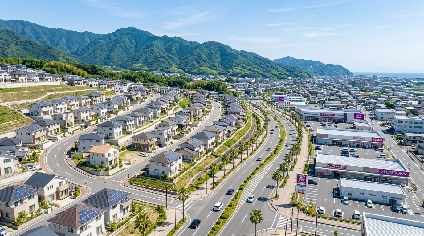
For the 2026 Disaster Prevention Week, one of the themes we real estate analysts are watching most closely is the "voluntary compact city formation" and "relocation to higher ground" in regional cities located within the projected inundation zones of the Nankai Trough Earthquake. Nangoku City is precisely at the forefront of this paradigm shift. The center of gravity for people's livelihoods and economic activities is moving from the ocean-facing southern areas to the more elevated, geologically stable north, or along the major traffic artery, the Nangoku Bypass.
This movement is fundamentally rewriting the risk-return structure of real estate investment. Relying on outdated market perceptions will cause you to miss this dynamic wave of demand. In this article, backed by the latest primary data obtained from the Ministry of Land, Infrastructure, Transport and Tourism (国土交通省) API and hazard information from the Geospatial Information Authority of Japan (国土地理院), we will reveal the current landscape of real estate value in Nangoku City.
2. The Latest Status of Projected Nankai Trough Earthquake Inundation Zones and Hazard Maps in Nangoku City
In real estate investment, accurately grasping local hazard information is an "absolute prerequisite" before even calculating returns. According to the data acquired this time for Nangoku City (around latitude 33.5783, longitude 133.6431), the disaster prevention environment here is by no means one to be viewed with optimism.
First, regarding flood risk, the data clearly indicates a "maximum inundation depth of 0.5 to 3m (Rank 2)." An inundation of 0.5 to 3 meters would completely submerge the first floor of a typical wooden house. For commercial stores, this level of flooding would cause devastating damage to merchandise, fixtures, and precision equipment. Furthermore, regarding sediment disaster risks, there is a designated risk for the occurrence of "debris flows."
[Summary of Real Estate Transactions and Environmental Data for Nangoku City (Around the City Center)]
| Item | Data Details (Targeting 2021–2025) |
|---|---|
| Number of Transactions | 630 |
| Average / Median Transaction Price | Approx. 13.62 million yen / Approx. 7.05 million yen |
| Lowest / Highest Transaction Price | Approx. 1,000 yen / 320 million yen |
| Average Unit Price | Approx. 44,000 yen/㎡ |
| Hazard Risk (Flood) | Risk present (Max inundation depth 0.5–3m) |
| Hazard Risk (Sediment) | Risk present (Risk of debris flow phenomena) |
| Nearest Station / Daily Passengers | Gomen Station (後免駅) (Shikoku Railway Company (四国旅客鉄道)) / Average 3,642 passengers/day |
| Zoning / Building Coverage & Floor Area Ratio | Category I Residential Zone / 60%・200% |
Given that these hazard items are flagged as having "risk present," we strongly urge readers to always check the latest hazard map and local micro-topography (e.g., whether the site is in a slight depression compared to its surroundings) before purchasing a property.
On the other hand, the presence of risk does not mean the property is unfit for investment. In areas where an inundation depth of 0.5 to 3 meters is expected, it is entirely possible to add value to the property by employing "adaptation measures." These include designing the first floor as a parking lot (pilotis structure) and allocating the second floor and above for residential or commercial space, installing water-stop panels, and placing electrical equipment at higher elevations. Properly fearing hazards and pricing them into architectural plans and yield calculations (adding a risk premium) is exactly what characterizes a professional property evaluator.
3. From the Coast to the Inland: The Drastic Change in Housing Demand Driven by the Promotion of Relocation to Higher Ground
Heightened resident awareness of hazard risks is driving a geographical shift in housing demand. The number of real estate transactions in Nangoku City between 2021 and 2025 reached 630, forming a highly active market for a regional city. The average transaction price is approximately 13.62 million yen, with a median of about 7.05 million yen, indicating that transactions are trending in a price range accessible to actual end-users.
The graph below shows the trend of actual transaction prices in Nangoku City.
Let's look at specific transaction examples. In the Kogome district (小籠地区) of Nangoku City, a lightweight steel-framed house built in 1984 (land area 510㎡) was traded for approximately 12 million yen. This area is designated as a "Category I Residential Zone (Building Coverage Ratio 60%, Floor Area Ratio 200%)," allowing for flexible land use, such as rebuilding taking advantage of the spacious lot or converting it into a two-generation home. Additionally, there is a track record of a residential plot (420㎡) alone selling for about 8 million yen (unit price approx. 19,000 yen/㎡) in the same district, indicating solid demand for residential land inland.
For families, the educational environment is a factor that cannot be overlooked. The target area is within the school districts of "Nagaoka Elementary School (長岡小学校)" and "Kacho Junior High School (香長中学校)," ensuring stable rental and purchasing demand from the child-rearing demographic. The current defining characteristic of Nangoku City is this drastic shift in housing demand from coastal areas with high tsunami risks to inland areas that offer a calm living and educational environment.
💡 Research off-market properties and residential land in highly safe inland areas 👉
4. Accelerated Shift of Commercial Facility and Store Development Along the National Route 55 "Nangoku Bypass"
Following the shift in housing demand, the location of commercial facilities is also facing a major turning point. The primary recipient of this shift is the vicinity of the traffic artery, the National Route 55 "Nangoku Bypass."
Looking at the raw data, a wooden store built in 1970 (land and building) in the Kamisuematsu district (上末松地区) was traded for about 19 million yen. What is noteworthy is that this property is located in an "Urbanization Control Area (Building Coverage Ratio 60%, Floor Area Ratio 200%)." The fact that an existing commercial property is traded at this price in an Urbanization Control Area, where new development is restricted in principle, suggests the high commercial potential around the bypass. However, properties in such areas tend to have sparse public transaction data; therefore, careful comparison with neighborhood market prices and in-depth consultations with local authorities regarding the feasibility of rebuilding or hurdles to changing use are indispensable.
The infrastructure supporting this commercial demand is also well-established. The nearest station for the target area, "Gomen Station" operated by the Shikoku Railway Company, boasts an average of 3,642 daily passengers, functioning as an access hub to the center of Kochi City. In addition, medical institutions such as "Nishimura Dental Clinic (西村歯科医院)" are scattered around the area (one confirmed in this neighborhood sample), showing an increasing concentration of essential lifestyle facilities.
In regional cities with advanced motorization, areas along a bypass are "prime locations" for roadside stores. The trend of relocating and consolidating aging coastal stores along the bypass, driven by both disaster prevention and customer attraction needs, is likely to accelerate further in the future.
5. The Reality of Land Price Fluctuations Brought About by Collective Disaster Relocation Promotion Projects and Municipality-Led Infrastructure Development
The shift in a city's center of gravity is strongly propelled not only by the voluntary actions of residents and companies but also by government-led infrastructure development and collective disaster relocation promotion projects. Summarizing the timeline of recent development and relocation in Nangoku City looks like this:
- Late 2010s: Accompanying the revision of Nankai Trough Earthquake damage estimates, discussions on relocating functions inland gained momentum in parallel with the construction of tsunami evacuation towers in coastal areas.
- 2021–2023: Expansion of the road network around the Nangoku Bypass and land readjustment projects in inland areas progressed. From this period, the number of residential and commercial transactions in inland areas noticeably increased (reflected in our 630 transaction data points).
- 2024–2025: A succession of local companies relocating their offices and chain stores expanding from a wider region caused localized land price surges along the bypass.
- 2026 (Present): Disaster prevention infrastructure development has settled down, and the city's brand as a new "safe city" has taken root. The market has entered a phase of re-evaluating real estate values.
The ripple effects of such development are also evident in surrounding agricultural land transactions. In our data, 330㎡ of agricultural land in the Kamisuematsu district sold for about 500,000 yen, and 1,400㎡ of agricultural land in the Tamura district (田村地区) sold for about 130,000 yen. Although prices are extremely low due to restrictions under the Agricultural Land Act, developers might be actively maneuvering behind the scenes, eyeing future incorporation into Urbanization Promotion Areas or conversion into logistics and commercial land using special provisions.
💡 Search for potential development and conversion sites linked to municipal development plans 👉
6. Restructuring Corporate Locations: The Northward Shift of Logistics and Office Demand with BCP (Business Continuity Planning) in Mind
From the perspective of real estate transaction scale, the data point of a highest transaction price of "320 million yen" cannot be overlooked. In a market where the average price is around 13.62 million yen, this outstanding transaction amount strongly indicates the trade of a large-scale commercial property (such as a logistics warehouse, factory, or core office) rather than a simple individual home or small store.
Recently, many companies have prioritized the maintenance of supply chains during natural disasters as the most critical issue in formulating their Business Continuity Planning (BCP). A "northward shift of corporate locations" is occurring, where companies sell coastal offices that are at risk of tsunami inundation and move their bases inland, where water damage risks are relatively lower and access to expressway interchanges is easier.
Nangoku City offers excellent access to the Kochi Expressway (Nangoku IC) (高知自動車道(南国IC)) and Kochi Ryoma Airport (高知龍馬空港), holding potential as a logistics hub covering the entire Shikoku region. The fact that investment money on the scale of 320 million yen is moving is proof that this area is recognized for its high strategic value in the B2B (business-to-business) real estate market.
7. Key "Property Evaluation" Points for B2B Real Estate Investment in the Nangoku City Area
As we have seen, Nangoku City is an attractive investment market undergoing dynamic transformation centered around the keyword "disaster prevention." However, to enter this market as a professional investor, you need to grasp several "key evaluation points":
- Verification of Micro-Hazards: As mentioned earlier, the area as a whole harbors flood risks of 0.5 to 3 meters and debris flow risks. Even within the same neighborhood, a few dozen centimeters of elevation difference can separate success from failure. The meticulousness to check elevation data from the Geospatial Information Authority of Japan and past inundation records down to the block level is required.
- Handling of Urbanization Control Areas: As seen in the Kamisuematsu district (1970-built store, approx. 19 million yen), transactions exist within Urbanization Control Areas. The source of value for these properties lies in whether they meet rebuilding permission requirements under the City Planning Act (such as certification as an existing residential lot). Neglecting preliminary consultations with local authorities risks being saddled with a non-performing asset.
- Supplementing Data Blind Spots: In areas or property types where public transaction data is sparse, such as agricultural land or specialized business plots, it is dangerous to simply apply the average unit price (approx. 44,000 yen/㎡). Valuations through a multifaceted approach, including comparisons with neighborhood market prices and reverse calculations from roadside land prices, are essential.
💡 Acquire expert-level property evaluation data to minimize investment risks 👉
8. Conclusion: Building a Next-Generation Real Estate Portfolio that Prices in Disaster Risks
In observation of the 2026 Disaster Prevention Week, what emerges from the latest data on Nangoku City, Kochi Prefecture, is a market autonomously optimizing itself against the massive risk of a Nankai Trough Earthquake.
The shift in housing demand from the coast to inland and elevated areas, the commercialization along the Nangoku Bypass, and large-scale commercial investments anticipating corporate BCP (transactions up to 320 million yen)—all of these are testaments to the "desire for safety" and the "creation of new economic value" engraved within the 630 transaction records and the average market price of 13.62 million yen.
In real estate investment, disaster risk is no longer something to be avoided; it has become a variable to be quantitatively analyzed and priced in. Players who can accurately grasp the risks of 0.5 to 3-meter floods and debris flows and prepare architectural and physical solutions for them will lead the next generation of regional revitalization and the real estate market.
The latest and most accurate primary data is always essential for investment decisions. By registering for a free membership with Mekiki Research, you will be able to extract the Ministry of Land, Infrastructure, Transport and Tourism's real estate transaction data and hazard information used in this blog directly through your Claude or ChatGPT (via MCP integration). Please utilize this to delve deeper into research with your own AI assistant and build a highly reliable investment strategy.