
As we approach the nationwide "Disaster Prevention Week" in 2026, the real estate market's greatest concern is preparedness for unprecedented natural disasters, most notably the Nankai Trough Megaquake (南海トラフ巨大地震). Compounded by extreme weather events driven by climate change, urban resilience has become the most critical factor in determining real estate value.
This article focuses on the central area of Matsuyama City, Ehime Prefecture (愛媛県松山市), which boasts the largest population in Shikoku (四国). Based on the latest data acquired by Mekiki Research (物件目利きリサーチ), we will thoroughly examine the correlation between inundation/seismic risks and land price trends from the perspective of a professional real estate analyst.
Investment Insights Gained from This Article:
- The correlation between disaster risks and land prices, as demonstrated by actual transaction data (6,940 cases) in central Matsuyama City from 2021 to 2025.
- The specific impacts of and countermeasures for estimated flood depths of 3 to 5 meters and debris flow risks on real estate valuation.
- The latest real estate investment strategies and key points for area selection in 2026, incorporating enhanced disaster prevention capabilities.
💡 [FREE] Want to analyze the latest real estate market prices and hazard information with your own AI? You can dive deep into the actual transaction data and hazard information from the Ministry of Land, Infrastructure, Transport and Tourism (国土交通省) explained in this article on your own. Check the latest data for Matsuyama City, Ehime Prefecture on Mekiki Research 👉
1. Disaster Prevention Week 2026: The Growing Crisis Awareness of the Nankai Trough Earthquake and Its Impact on the Real Estate Market
The most prominent paradigm shift in Japan's 2026 real estate market is that "disaster resilience" now translates directly into "asset value." With the institutionalization of the Nankai Trough Earthquake Extra Information (南海トラフ地震臨時情報) system and a heightened sense of urgency regarding megaquakes, checking hazard maps has become an absolute prerequisite in real estate transactions—from institutional investors to homebuyers seeking primary residences.
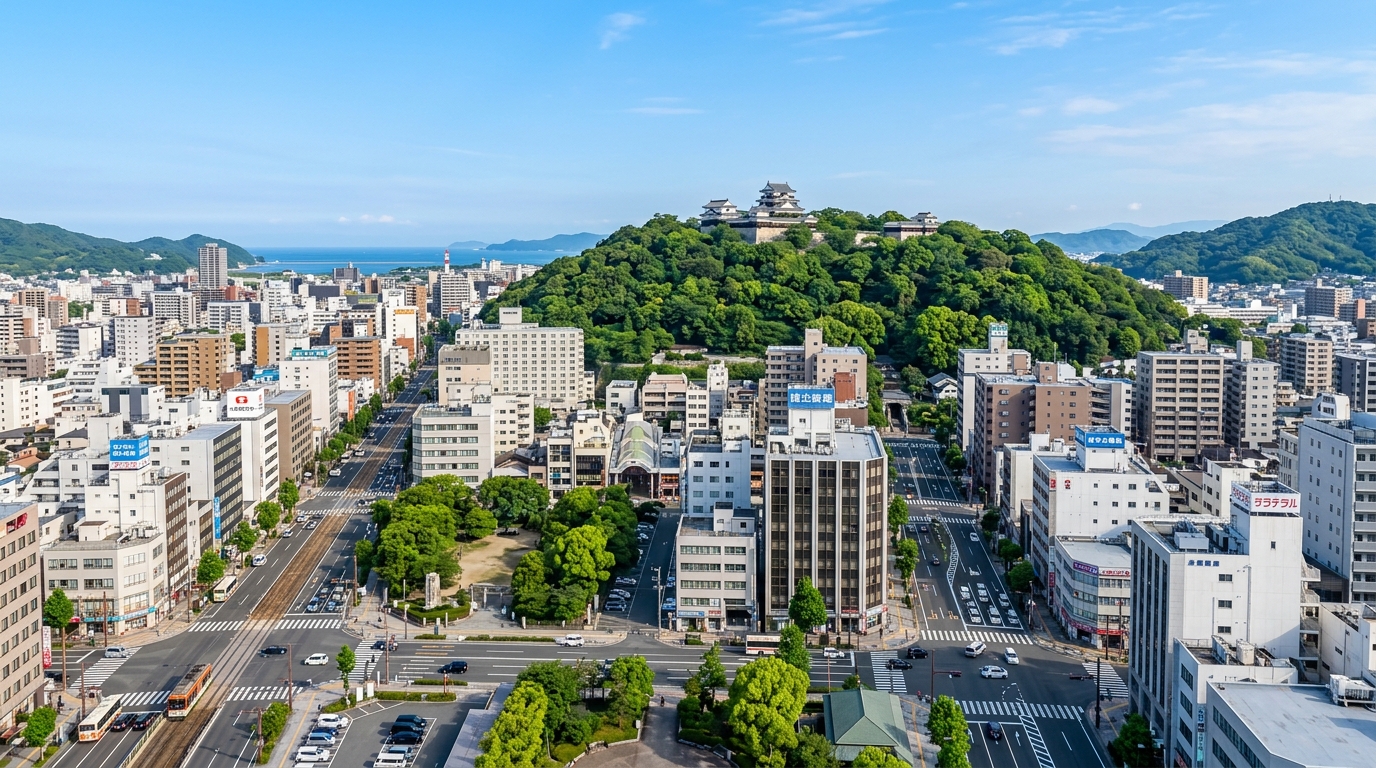
Matsuyama City is a core regional city that has long flourished as the economic and cultural hub of Shikoku. While it is blessed with a mild climate and abundant nature facing the Seto Inland Sea (瀬戸内海), a Nankai Trough Megaquake is expected to bring intense tremors and tsunamis, as well as liquefaction and inundation damage in coastal areas and river basins.
From a real estate analyst's perspective, urban appeal and disaster risk are always in a trade-off relationship. However, the prevailing strategy in the modern real estate market is no longer simply "avoiding risk," but rather "accurately evaluating risk and acquiring properties equipped with appropriate countermeasures (such as Business Continuity Planning [BCP] and structural reinforcements) at fair prices." In this feature, we will use actual transaction data from Matsuyama City to unravel how the market factors disaster risks into property pricing.
2. Geographical Characteristics of Central Matsuyama City and Maximum Anticipated Disaster Risks
First, let's grasp the overall picture of the real estate market and urban characteristics of central Matsuyama City (around latitude: 33.8392, longitude: 132.7656) through data. The following graph and table present actual data from 2021 to 2025 retrieved from the backend system of Mekiki Research (utilizing the Ministry of Land, Infrastructure, Transport and Tourism API and hazard maps from the Geospatial Information Authority of Japan [国土地理院]).
| Item | Data Details (Actual Data Retrieved by Mekiki Research) |
|---|---|
| Target Municipality | Matsuyama City, Ehime Prefecture (City Code: 38201) |
| Target Period / Cumulative Transactions | 2021–2025 / 6,940 cases |
| Average / Median Transaction Price | Approx. 24.5 million yen / 16 million yen |
| Highest Transaction Price / Average Unit Price | 1.5 billion yen / Approx. 80,000 yen/sqm |
| Nearest Station / Daily Passengers | Matsuyamashi Station (松山市駅) (Iyo Railway [伊予鉄道]) / 17,758 people |
| Primary Zoning (City Center) | Commercial Zone (Building Coverage Ratio: 80% / Floor Area Ratio: 600%) |
| Flood Hazard Risk | At Risk (Maximum Inundation Depth Rank 3: 3–5m) |
| Landslide Disaster Risk | At Risk (Debris Flow) |
| Neighborhood Amenities (Medical / Schools) | 64 Medical Facilities / Misake Elementary School (味酒小学校), Katsuyama Junior High School (勝山中学校) |
As the data shows, central Matsuyama City is a critical transportation hub anchored by Matsuyamashi Station, boasting approximately 17,758 daily passengers—one of the highest figures in Shikoku. The zoning is largely designated as a Commercial Zone allowing for high-density utilization with a Building Coverage Ratio (BCR) of 80% and a Floor Area Ratio (FAR) of 600%, resulting in a highly concentrated urban infrastructure.
Furthermore, it is worth noting that the surrounding area is packed with 64 medical institutions, including Matsuyama Kasagi Memorial Cardiovascular Hospital (松山笠置記念心臓血管病院), Nomoto Memorial Hospital (野本記念病院), and Kajiura Hospital (梶浦病院). The educational environment is also well-established with schools like Misake Elementary School and Katsuyama Junior High School, creating an extremely attractive living environment for primary homebuyers. The average transaction price of roughly 24.5 million yen and a median of 16 million yen demonstrate solid demand for a regional city, with large-scale commercial real estate transactions occasionally reaching as high as 1.5 billion yen.
However, amidst this prosperity, hazard information displays clear warning signals.
3. Correlation Analysis Between Tsunami/Inland Flooding Hazards and Land Price Trends in the Shiroyama (城山) and Prefectural Office (県庁) Areas
Inundation risk goes hand-in-hand with the concentration of urban functions. According to actual data, specific areas in central Matsuyama City are classified as "at risk" for flood hazards, with the maximum estimated inundation depth reaching "Rank 3 (3–5 meters)."
As an analyst, I want to strongly caution real estate investors and prospective homebuyers about the gravity of this "3 to 5 meters" metric. For a standard detached house, this means being submerged up to the eaves of the second floor. Even for condominiums and commercial buildings, it means the first-floor entrance, pilotis, and underground electrical equipment rooms would be completely underwater. Before purchasing, it is essential not only to review the Important Matters Explanation Document (重要事項説明書) but also to personally walk the area and verify the micro-topography (elevation differences) alongside the hazard map.
Looking at the correlation with land price trends, price formation that prices in this risk is advancing in areas where inundation risk is evident. Particularly in Commercial Zones with a 600% FAR, developers constructing new buildings are compelled to implement water damage countermeasures (BCP measures), such as relocating electrical equipment to the roof or intermediate floors. The resulting increase in construction costs acts as downward pressure on land acquisition prices (raw land prices). On the flip side, newly built or relatively new properties equipped with adequate water-resistant infrastructure become rare commodities in the area, enjoying strong support from tenants and maintaining high unit rents.
4. Seismic and Landslide Risks and Regional Resilience in the Dogo Onsen (道後温泉) and Joto (城東) Areas
When discussing Matsuyama City's real estate market, one cannot overlook the Dogo Onsen and Joto areas spreading to the east. These areas feature scenic residential neighborhoods, but their location at the foothills of mountains introduces different disaster risks.
Looking at actual data, we can confirm transaction cases in the Ishite Shiraishi (石手白石) area (Category I Exclusively Low-Rise Residential Zone, BCR 50%, FAR 80%):
- Residential Land (Land and Building): 27 million yen (120 sqm, built in 2020, wooden structure)
- Residential Land (Land only): 11 million yen (Approx. 55,000 yen/sqm, 190 sqm)
- Residential Land (Land only): 6.8 million yen (Approx. 29,000 yen/sqm, 230 sqm)
While highly popular as a quiet, low-rise residential neighborhood, hazard data explicitly indicates "Landslide Disaster Risk (Debris Flow)." As a warning to readers, when purchasing land near mountains, always check the local municipality's erosion control designation status and the condition of existing retaining walls (e.g., loss of function in weep holes or the presence of cracks).
The relatively cheap unit price of around 29,000 yen/sqm seen in land-only transactions in Ishite Shiraishi is highly likely a result of negative pricing impacts. This could be due to designations as Special Warning Areas (Red Zones) or Warning Areas (Yellow Zones) for landslide disasters, or the anticipated costs of additional safety measures required for construction, such as rebuilding robust retaining walls or executing ground improvement work. Conversely, the transaction of a wooden house built in 2020 for 27 million yen demonstrates that properties meeting the latest seismic standards and landslide countermeasures are properly evaluated for their resilience and traded actively in the market.
💡 Check the disaster risks and land price trends of your target area right now! Visualize hazard information for specific town names or station surroundings you are considering for investment. Start your area analysis with Mekiki Research 👉
5. The Impact of Enhanced Disaster Prevention Functions in the JR Matsuyama Station (JR松山駅) Redevelopment on Real Estate Value
A large-scale urban redevelopment project, including the elevation of tracks around JR Matsuyama Station, is underway in Matsuyama City, serving as a catalyst for the entire real estate market. One of the major goals of this redevelopment is not only to integrate the previously divided east-west transportation nodes but also to "build a disaster prevention hub" that functions as a wide-area evacuation site and a temporary shelter.
Let's look at transaction data for the neighboring residential area of Imazaike (今在家).
- Residential Land (Land only): 13 million yen (Approx. 82,000 yen/sqm, 160 sqm, Category I Exclusively Low-Rise Residential Zone)
- Residential Land (Land and Building): 27 million yen (140 sqm, wooden structure)
What demands attention here is that the building age (buildingYear) data for the Imazaike "Land and Building" transaction is "null" (missing). In real estate transactions, it is not uncommon to see areas with thin public transaction data, unregistered expansions/renovations, or land transactions that include old houses of unknown age. Investors must accept missing data at face value and take necessary steps to determine the fair price of such properties. This entails comparing the property with the vacant land market price in the vicinity (approx. 82,000 yen/sqm) and invariably commissioning a detailed property inspection (current condition survey) by an expert.
Residential areas adjacent to redeveloped station zones with enhanced disaster prevention features are expected to maintain or appreciate in asset value over time. Consequently, an investment strategy that involves acquiring these older properties or those with unknown ages at a low cost and renovating them to meet modern seismic and energy-efficiency standards harbors immense potential.
6. Decoding the Gap Between Liquefaction Risks and Market Prices in Matsuyama City Using Mekiki Research
In a Nankai Trough Megaquake, the differential settlement of buildings caused by "liquefaction" is just as terrifying, if not more so, than the shaking itself. Ground liquefaction inflicts fatal damage, especially on heavy Reinforced Concrete (RC) structures.
From the actual data, let's examine a transaction case of a multi-family dwelling in Iwasakicho (岩崎町) (Category I Mid/High-Rise Oriented Residential Zone, BCR 60% / FAR 200%).
- Residential Land (Land and Building): 29 million yen (165 sqm, built in 1985, RC structure)
This RC multi-family dwelling, transacted at 29 million yen, was built in 1985. Since it was constructed under the "New Seismic Standards" implemented following the 1981 revision of the Building Standards Act (建築基準法), a certain level of earthquake resistance is guaranteed. However, now that it is approaching 40 years old, concerns arise over the carbonation of concrete and the progression of cracks accumulating from past minor earthquakes.
Even more critical is the ground risk. In the flatlands of Matsuyama City, the risk of liquefaction is not zero. The standards for ground surveys and piling in 1985 are sometimes deemed insufficient by today's latest insights. Given Matsuyama City's average unit price of roughly 80,000 yen/sqm, the fact that an RC multi-family dwelling of this size was traded for 29 million yen suggests that the potential risk premiums required for future large-scale repair costs, seismic retrofitting, and liquefaction countermeasures have been discounted (creating a gap) from the actual market price. Before jumping at a high gross yield, rigorous due diligence on ground risk is absolutely required.
7. Future Real Estate Investment and Development Strategies in the Matsuyama Area Factoring in Disaster Risks
What the massive dataset of 6,940 cumulative transactions in Matsuyama City as of 2026 tells us is a "polarization of risks" and the ensuing "polarization of prices."
The existence of large-scale transactions up to 1.5 billion yen is proof that institutional investors and major developers highly evaluate Matsuyama City's potential. They fully leverage the 600% FAR of Commercial Zones while executing "risk hedging" backed by overwhelming capital. This includes adopting pilotis structures to overcome Rank 3 (3–5m) inundation, installing emergency power supplies on upper floors, and introducing base-isolation and vibration-control structures.
On the other hand, the optimal strategy for individual real estate investors and primary homebuyers from 2026 onwards revolves around the following three points:
- Hazard Map Contrarian Strategy: Target existing properties located on plateaus or slightly elevated ground where landslide (debris flow) risks and inundation risks of 3 meters or deeper are completely eliminated.
- Confirming Infrastructure Redundancy: Choose properties in areas where infrastructure recovery during disasters is prioritized, such as around Matsuyamashi Station, which is close to medical facilities (a cluster of 64 locations) and administrative bodies.
- Value-Add for Properties with Missing Data: Revitalize undervalued properties hidden in areas with thin data or properties of unknown age through precise inspections and seismic retrofitting.
8. Conclusion: How the Visualization of Urban Disaster Resilience is Changing Real Estate Evaluation Standards in Regional Hub Cities
In today's feature, timed with Disaster Prevention Week, we analyzed the forefront of the real estate market preparing for the Nankai Trough Earthquake based on actual data from central Matsuyama City.
With an average transaction price of roughly 24.5 million yen, a transportation infrastructure used by approximately 17,758 people daily, and a concentration of 64 medical institutions, Matsuyama City undeniably harbors high investment potential. However, natural threats such as flood risks with inundation depths of 3 to 5 meters and debris flow risks are always present beneath the surface.
Future real estate value will no longer be determined solely by "distance from the station" or "building age." As the "visualization of urban disaster resilience" progresses, properties that correctly acknowledge risks and possess the resilience to withstand them are the ones that will continue to maintain true asset value.
For those considering real estate investment or purchasing a home, we urge you to aim for a balance of safety and asset value through calm, data-driven judgment.
By registering for a free account, you can pull the actual transaction data from the Ministry of Land, Infrastructure, Transport and Tourism and hazard information used in this blog directly from your Claude or ChatGPT (via MCP integration [MCP連携]). Please take advantage of this tool to continue your own AI-powered research and uncover prime properties faster than anyone else.