
As "Disaster Prevention Day (防災の日)" on September 1, 2026, approaches, vigilance against disaster risks is rising across Japan. This is especially true in Miyazaki City, Miyazaki Prefecture (宮崎県宮崎市), which sits directly within the projected epicenter zone of the Nankai Trough Megaquake (南海トラフ巨大地震). Faced with the constant threat of tsunamis and floods, the real estate market here is placing an unprecedented emphasis on disaster preparedness.
Fifteen years after the Great East Japan Earthquake (東日本大震災), one of the greatest lessons we have learned from that unprecedented disaster is the hard truth that "risks indicated on hazard maps decisively shape real estate values over the long term." The sharp plunge in land prices along coastlines nationwide—not just in the disaster-stricken areas—and the inversely proportional surge in demand for elevated inland areas have forged a new paradigm in the real estate market: the "polarization of land prices."
By cross-referencing the latest real estate transaction data with hazard information, this article provides an in-depth analysis of land price trends in coastal risk zones versus elevated inland areas, using Miyazaki City as a case study. We will also explore the latest trends in rental demand driven by heightened disaster awareness.
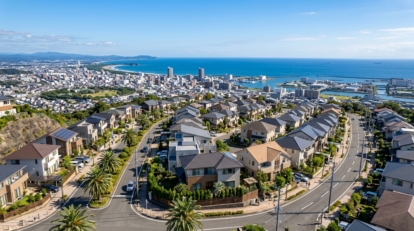
1. Just Before Disaster Prevention Day: The Current State of Tsunami/Flood Risks and Hazard Maps in Miyazaki City as of 2026
While Miyazaki City boasts a beautiful coastline facing the Hyuganada Sea (日向灘), it is projected to be hit by maximum-class tsunamis in the event of a Nankai Trough earthquake. Furthermore, the Oyodo River (大淀川), a Class A river, flows straight through the city center, leaving the area constantly exposed to risks of both inland and river flooding from typhoons and torrential rains.
According to actual data gathered from the real estate analysis platform "Bukken Mekiki Research (物件目利きリサーチ)" for central Miyazaki City (Latitude: 31.9111, Longitude: 131.4239), the hazard map for the target area reveals a very severe reality: "Flood Risk Present (Maximum Inundation Depth Rank 3: 3 to 5 meters)." An inundation depth of 3 to 5 meters means water could reach the second floor of a standard detached house—a life-threatening level of risk. Real estate investors and prospective homebuyers must never take this lightly. It is essential to exercise extreme caution by always checking hazard maps before purchasing and carefully reading the explanations of flood risks in the Important Matters Explanation (重要事項説明).
On the other hand, the landslide disaster risk at this exact location is listed as "None (No specific phenomena designated)." Accurately understanding these localized risk profiles—where flood risk is exceptionally high, but there are no concerns about landslides or debris flows—is indispensable for future real estate valuation. Thus, investors are required to decipher detailed hazard data, recognizing that even within the same area, a property might be "vulnerable to water but safe from landslides."
2. Lessons from the Great East Japan Earthquake: Medium- to Long-Term Impacts of Disaster Risks on the Real Estate Market
It is worth reflecting on the medium- to long-term impacts the Great East Japan Earthquake had on the real estate market. Following March 11, 2011, coastal areas in the affected regions suffered devastating tsunami damage, forcing many residents to relocate to safer inland or elevated areas. Consequently, coastal land prices plummeted, and transactions stagnated for a prolonged period.
Conversely, inland hilly regions and elevated residential areas that escaped the tsunami saw a localized spike in land prices due to a surge in housing demand from evacuees and relocators. This "premium for safe land" was not a passing trend; it has remained entrenched for over a decade. In short, the ultimate lesson of the Great East Japan Earthquake is that "the moment invisible disaster risks materialize, the hierarchy of real estate values is completely overturned."
For Miyazaki City, this lesson is by no means someone else's problem. As the probability of a Nankai Trough earthquake increases year by year, the scrutiny from investors and financial institutions has become far more severe. Loan screening for properties located in hazard map red zones (disaster danger zones) and yellow zones has tightened, raising hurdles for financing through measures like lowered LTV (Loan-to-Value) ratios and shortened loan terms. Disaster risk has evolved from a mere "just-in-case precaution" into the "most critical factor" directly dictating real estate liquidity and asset value.
3. Changes in Real Estate Valuation and Rental Demand in Coastal Risk Zones (Aoshima, Hitotsuba Areas, etc.)
Real estate valuations in coastal and low-lying areas of Miyazaki City strongly reflect the aforementioned tsunami and flood risks. While renowned tourist destinations like Aoshima (青島) and resort-heavy areas like Hitotsuba (一ツ葉) still command a certain level of demand due to their scenic views, caution is growing regarding long-term asset retention.
Actual data obtained includes transaction examples from areas with these low-lying or coastal characteristics. For instance, a residential lot (land only, 175 sq.m., semi-industrial zone, 60% building coverage ratio / 200% floor area ratio) in Odocho (小戸町), located near the mouth of the Oyodo River, traded at 5 million yen—a relatively suppressed unit price of about 30,000 yen per sq.m. (Q1 2021). Furthermore, in the coastal Oaza Akae (大字赤江) area near the airport, a sprawling 9,999 sq.m. property with a building (office, steel-framed, built in 1990, industrial zone) was sold for approximately 53 million yen.
What can be gleaned from this data is a shifting trend in coastal risk zones: away from actual housing demand and toward commercial or industrial use, or investments prioritizing short-term yields. In terms of rental demand, a "demand divide" is occurring. Families are gravitating toward safe, elevated areas, while single residents and specific businesses choose coastal or low-lying areas, prioritizing location convenience and lower rent. For commercial properties, from a BCP (Business Continuity Planning) perspective, a major dividing line in property valuation is whether physical risk mitigation measures have been implemented—such as making the ground floor a non-residential space like a parking lot and placing critical equipment on upper floors.
4. The Population Shift to Elevated Inland Areas (Ikumedai, Otsukadai, etc.) and the Mechanics of Land Price Increases
While wariness toward coastal areas grows, elevated inland areas in Miyazaki City have solidified their reputation as "safe assets." Residential developments carved into hilly terrain, such as Ikumedai (生目台), Otsukadai (大塚台), and Kaorusaka (薫る坂), boast extremely low risks of tsunamis and flooding. Since the Great East Japan Earthquake, they have garnered strong support, particularly among families raising children.
The table below summarizes selected examples from the actual transaction data obtained for Miyazaki City in this survey, focusing on elevated inland areas.
| Transaction Period | District Name | Type | Use | Structure | Year Built | Area | Zoning | Transaction Price |
|---|---|---|---|---|---|---|---|---|
| Q1 2021 | Otsukadai-nishi (大塚台西) | Residential (Land and Building) | Housing | Wood | 1977 | 410㎡ | Category I Exclusively Low-Rise Residential Zone | 20 million yen |
| Q1 2021 | Kaorusaka (薫る坂) | Residential (Land and Building) | Housing | Wood | 1999 | 240㎡ | Category I Exclusively Low-Rise Residential Zone | 25 million yen |
| Q1 2021 | Kaorusaka (薫る坂) | Residential (Land and Building) | - | Wood | 1997 | 200㎡ | Category I Exclusively Low-Rise Residential Zone | 14 million yen |
| Q1 2021 | Gion (祇園) | Residential (Land and Building) | Housing | Lightweight Steel | 2003 | 350㎡ | Category I Exclusively Low-Rise Residential Zone | 47 million yen |
As is evident from the table, even an older wooden house built in 1977 in Otsukadai-nishi sold for 20 million yen, valued for its spacious 410 sq.m. lot and excellent living environment within a Category I Exclusively Low-Rise Residential Zone (40% building coverage ratio / 60% floor area ratio). In Kaorusaka, a relatively newer, upscale residential neighborhood, a wooden house built in 1999 traded for 25 million yen. Furthermore, in Gion, situated on a nearby elevation, a lightweight steel-framed house built in 2003 commanded a premium price of 47 million yen. Being designated as a Category I Exclusively Low-Rise Residential Zone—which allows for spacious site planning with building coverage ratios of 50–60% and floor area ratios of 60–100%—also underpins property values.
This population shift to elevated areas is not a fleeting fad; it represents a "structural demand for safety" rooted in the lessons of the Great East Japan Earthquake. The mechanism behind rising land prices in elevated areas is driven by excessive demand for limited safe land. As long as vigilance against a Nankai Trough earthquake remains, this trend is only expected to intensify.
5. Market Signals Indicated by Nankai Trough Megaquake Vigilance and the Polarization of Land Prices in Miyazaki City
Looking at the overall real estate market of Miyazaki City from a macro perspective, one can see that the aforementioned polarization between "coastal/low-lying risk areas" and "elevated inland areas" is intricately woven into the city's overall averages.
An analysis of the transaction data obtained for Miyazaki City during the 2021–2025 period (sample size: 6,023 transactions) shows an average transaction price of approximately 22.11 million yen and a median of 16 million yen. The average unit price was roughly 50,000 yen per sq.m. A crucial market signal to read from this is that the average (approx. 22.11 million yen) significantly exceeds the median (16 million yen).
This clearly illustrates a "distortion" and "polarization" in the market: a small number of high-value transactions (such as prime properties in safe, well-equipped elevated areas or large commercial properties in the city center) are pulling the average up, while the majority of standard transactions (such as those in risk-prone areas or aging properties) are occurring at or below the 16-million-yen price range. The extreme variance—with the highest transaction reaching 1.7 billion yen while the lowest was a mere 150 yen—also reflects a reality where values are separated like heaven and earth depending on location (the presence or absence of hazard risks) and usage. Investors must not be misled by superficial metrics like "the average yield in Miyazaki City," but rather discern which side of this polarizing wave their target investment sits on.
6. Surging Demand for Rental Properties with Disaster Resilience and the Approach Investors Should Take
As land price polarization progresses, significant shifts are also occurring in the decision-making of tenants in the rental market. For families in particular, in addition to traditional criteria like low rent and proximity to stations, questions like "Is it safe on the hazard map?" and "Does the building meet the latest seismic standards?" have become decisive factors in choosing a property.
Let’s examine the environmental data around our surveyed location (Latitude: 31.9111, Longitude: 131.4239). This area is zoned as a Category II Residential Zone, falling within the school districts of Oyodo Elementary School (大淀小学校) and Oyodo Junior High School (大淀中学校). Most notable is the abundance of medical facilities; there are as many as 28 medical institutions in the vicinity, ranging from large-scale hospitals like Miyazaki Medical Center Hospital (宮崎医療センター病院) and Wakakusa Hospital (若草病院) to smaller clinics like Ozora Clinic (大空クリニック).
Under normal circumstances, an area with such robust educational environments and medical infrastructure would be a prime location with exceptionally strong rental demand from families. However, as pointed out in Chapter 1, this specific spot carries a "flood risk with an inundation depth of 3 to 5 meters." Here, there are two approaches an investor should consider. The first is to pass on investing in this area and pivot to a solid family-oriented property investment in a hazard-free elevated area (like Otsukadai or Kaorusaka). The second is to intentionally invest here but differentiate the property as a "highly resilient rental with maximized disaster preparedness"—for example, by utilizing a piloti-style parking lot on the ground floor, installing emergency power supplies and stockpile storage, or restricting residential leasing to the upper floors. Since excellent access to medical facilities stimulates demand from the elderly and medical professionals, a property can be highly competitive if its risks are mitigated through physical infrastructure.
Note: In this survey data, the nearest station name and station passenger traffic are listed as null, suggesting a living environment with low reliance on railway networks and centered around a car-based society. For areas where public transaction and infrastructure data are sparse, field investigations and comparisons with neighborhood market rates are essential.
7. Precise Risk Analysis of Hazard Areas Leveraging the B2B SaaS "Bukken Mekiki Research"
As we have seen, the presence or absence of disaster risk has become a core element determining property value in the post-Great East Japan Earthquake real estate market. In cities like Miyazaki City, where high convenience and robust infrastructure form an intricate mosaic with severe flood and tsunami risks, it is extremely dangerous for inexperienced investors to assess properties based solely on intuition or gut feeling.
This is where data analysis tools like the B2B SaaS "Bukken Mekiki Research (物件目利きリサーチ)"—which was utilized in this article—prove their worth. Rather than merely referencing past transaction examples (such as the 53 million yen in Oaza Akae or the 5 million yen in Odocho), these tools instantly integrate macro and micro environmental data, including pinpoint hazard information for that exact location (e.g., 3–5m flood risk, no landslide risk), zoning, school districts, and the number of medical facilities, enabling risk analysis based on objective evidence.
In particular, when approaching financial institutions for loans, being able to create a persuasive, data-backed business plan—such as stating, "While this property is within a hazard area, past transaction data proves this level of demand, and its access to surrounding medical institutions like Miyazaki Medical Center Hospital (宮崎医療センター病院) ensures a specific rental demand"—serves as a decisive advantage for professional real estate operators.
8. Conclusion: Real Estate Investment Strategies in Miyazaki City Factoring in Disaster Risks, and Future Outlook
Ahead of Disaster Prevention Day in 2026, we have re-examined Miyazaki City's real estate market through the lens of lessons learned from the Great East Japan Earthquake. In conclusion, the ultimate real estate investment strategy in Miyazaki City boils down to "building a portfolio that fully accounts for disaster risks."
Although coastal and low-lying areas carry the heavy handicap of tsunami threats and 3–5m inundation risks, there is still room to carve out a unique market depending on the usage (commercial or single-resident) and the building's disaster resilience (hardware countermeasures). Meanwhile, elevated inland areas like Ikumedai, Otsukadai, and Kaorusaka are expected to maintain solid land prices and command premiums as safe havens for both practical housing demand and investment capital. The "divergence between the average and median" shown in over 6,000 transaction data points eloquently tells us that this polarization is already well underway.
Real estate is, quite literally, an "immovable asset." That is precisely why investors must thoroughly investigate the destiny (hazards) of the land before purchasing and adopt an approach that quantifies and evaluates future risks. In the face of an uncertain future involving a Nankai Trough Megaquake, the only certain line of defense we can take is "astute property assessment" rooted in cold, hard data analysis.
Check the latest land prices and hazard information for Miyazaki City on Mekiki Research 👉